
Bennett Analytics is a full service drone company. Our pilots are fully authorized by the Federal Aviation Administration (FAA) for the use of Unmanned Aerial Vehicles (UAV) for commercial purposes.
![]() We are capable of conducting precision agricultural studies with NDVI and LiDAR surveys. In addition, we have the ability to perform thermal inspections, and both 2D and 3D geographic mapping. We also offer hi-resolution imagery and videography, accurate up to 1 cm per pixel.
We are capable of conducting precision agricultural studies with NDVI and LiDAR surveys. In addition, we have the ability to perform thermal inspections, and both 2D and 3D geographic mapping. We also offer hi-resolution imagery and videography, accurate up to 1 cm per pixel.
While primarily based on the West coast, we have pilots positioned across the United States and are willing to travel to meet our customer’s needs. In most instances, in the Southern California region we can be on-site within 24 hours. Depending on the necessary equipment and shipping constraints, all other locations would require travel time of one to two days.
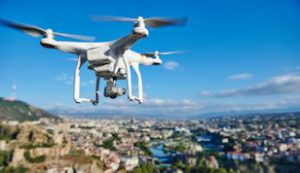
Phantom 3 flyover
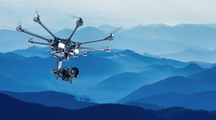
We fly two DJI S1000’s which are mounted with the finest Gremsy Gimbals. The advantage of this system is our ability to load any of our camera systems. In some cases, we can load two cameras to capture both video and thermal imaging data simultaneously. We also have three DJI Phantom 3s, two of these with 4K video capability.
What project can we help you with using UAVs?